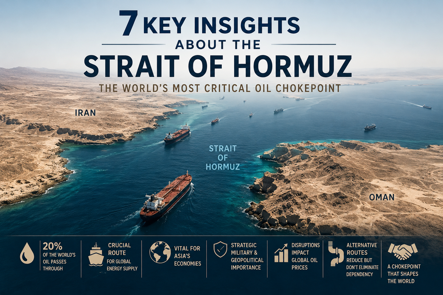

Few waterways carry as much weight literally and geopolitically as the Strait of Hormuz. Nestled between the Iranian coastline to the north and the Musandam Peninsula of Oman and the United Arab Emirates to the south, this narrow passage is the gateway between the Persian Gulf and the Gulf of Oman, funnelling a staggering share of the world's energy supply every single day. Understanding the most critical strait of hormuz facts has never been more relevant: in 2026, the strait became the focal point of the most severe energy supply disruption in modern history, triggering price shocks from Tokyo to London. Whether you are a student, an energy professional, or simply someone trying to make sense of today's headlines, these seven key insights will give you the full picture.
Location: Between Iran (north) and Oman/UAE (south)
Length: ~104 miles (167 km)
Narrowest width: ~21 miles (33 km)
Depth: 200–330 feet (60–100 m)
Daily oil flow (2025): ~20 million barrels
Share of global seaborne oil trade: ~25%


Geographical Overview of the Strait of Hormuz
Location and Borders
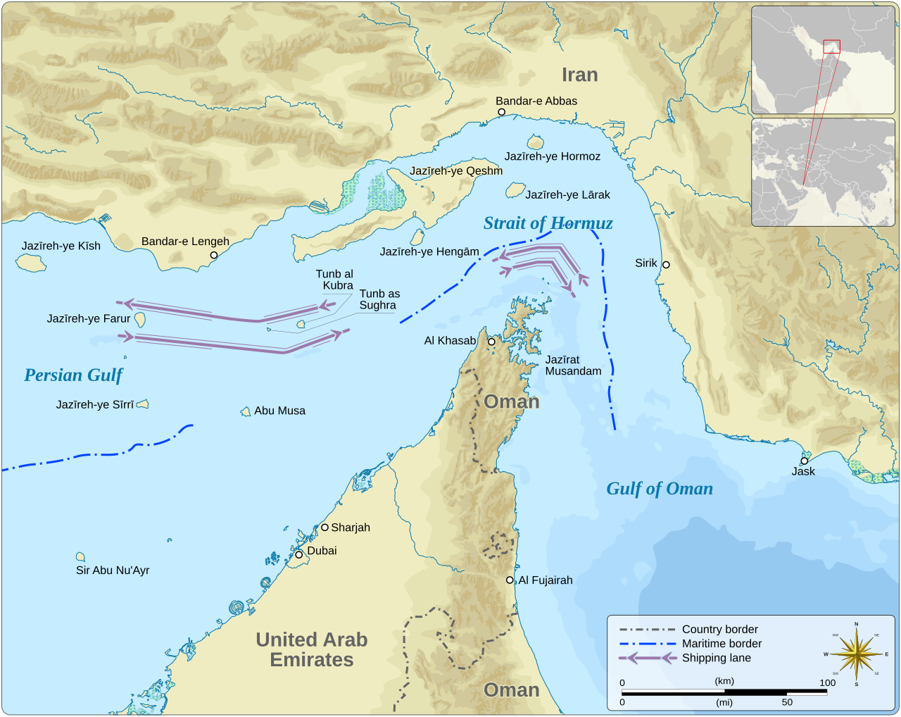
One of the most searched strait of hormuz facts is simply: where is the strait of hormuz? The answer is precise. The strait sits at the mouth of the Persian Gulf, bordered by Iran to the north and the Musandam Peninsula a territory of Oman geographically separated from the rest of the country to the south, with parts of the UAE coastline also flanking the passage. It connects the Persian Gulf to the Gulf of Oman, which then opens into the broader Arabian Sea. This positioning makes it the only sea route through which Persian Gulf nations can access open ocean shipping lanes.
Dimensions and Depth
| Dimension | Measurement |
|---|---|
| Length | ~104 miles (167 km) |
| Width (narrowest) | ~21 miles (33 km) |
| Width (widest) | ~60 miles (95 km) |
| Depth | 200–330 ft (60–100 m) |
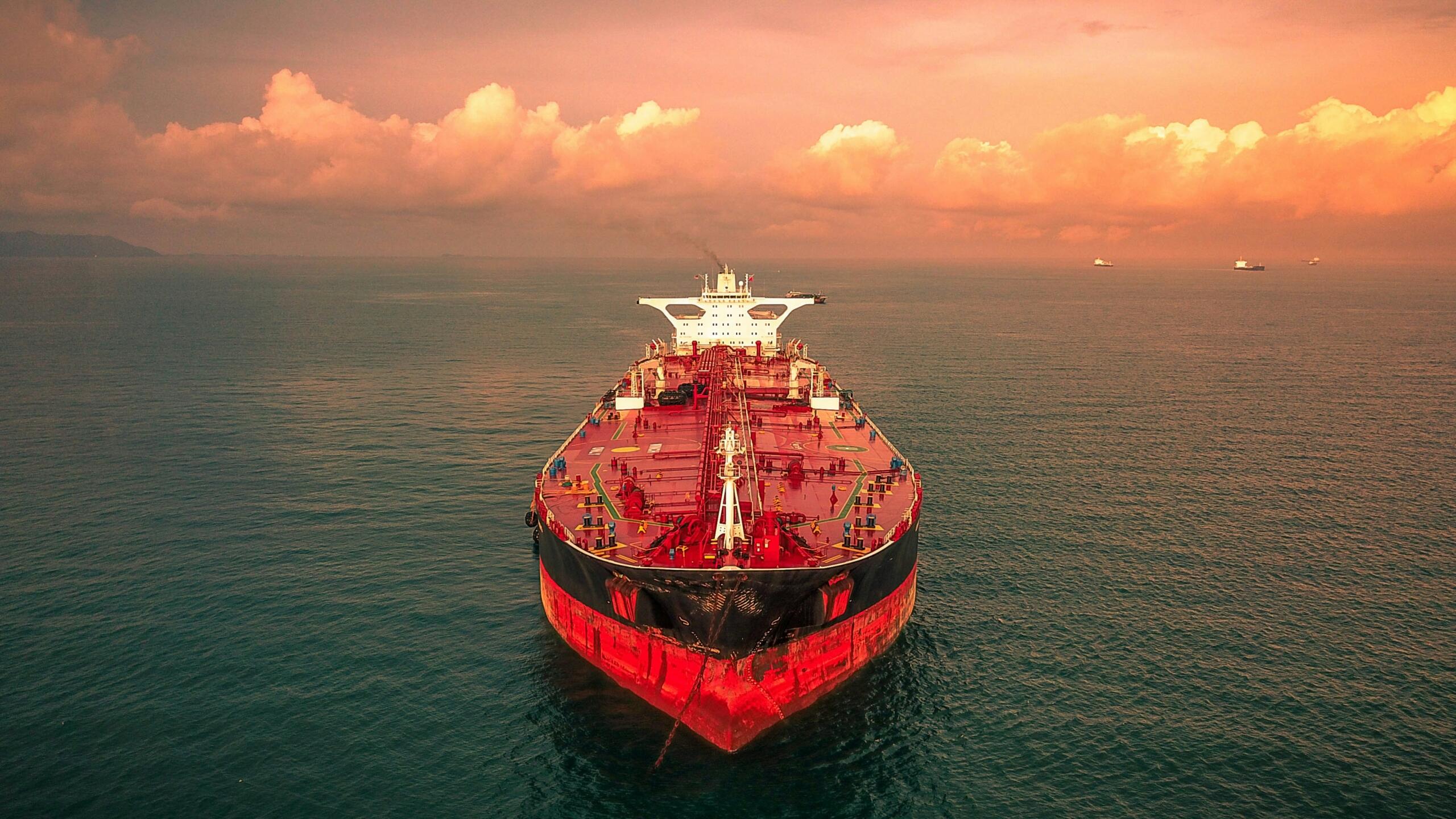
A common question alongside where is the strait of hormuz is how wide is strait of hormuz and the answer surprises many people. At its narrowest point, the navigable channel is only about 21 miles (33 km) wide, though the actual shipping lanes within that corridor are even tighter: two-mile-wide inbound and outbound lanes, separated by a two-mile buffer zone. The depth of 200 to 330 feet (60 to 100 metres) is sufficient to accommodate the world's largest crude oil tankers, known as Very Large Crude Carriers (VLCCs).
Strategic Importance in Global Trade
Oil and LNG Transit
The Strait of Hormuz, through which an average of 20 million barrels per day of crude oil and oil products were shipped in 2025, is one of the world's most critical oil transit chokepoints.
International Energy Agency (IEA)
Among all the strait of hormuz facts that define its global significance, the sheer volume of energy trade is the most striking. According to the IEA, approximately 20 million barrels per day of oil and petroleum products transited the strait in 2025, representing around 25% of the world's total seaborne oil trade. On top of that, significant quantities of liquefied natural gas (LNG) primarily from Qatar, one of the world's largest LNG exporters pass through the same narrow corridor.
The destinations are predominantly Asian: China and India together received 44% of the crude oil exports flowing through the strait in 2025. Japan and South Korea are also heavily reliant on Hormuz-routed supplies. For the Gulf states themselves including the UAE, Qatar, Bahrain, Kuwait, and Iraq the strait is not just important; for most of them, it is the only maritime export route.
Economic Implications of Disruptions
The economic stakes of any interruption are enormous. When the strait's shipping lanes are threatened, oil markets react immediately. Global ratings agency Fitch raised its average Brent crude forecast for 2026 from $70 to $87 per barrel in direct response to sustained disruptions caused by the 2026 closure. For importing nations across Asia and Europe, higher oil prices translate into rising energy bills, inflationary pressure, and slower economic growth. The ripple effects extend well beyond fuel: everything from fertiliser production to plastics manufacturing depends on affordable petrochemical feedstocks that travel through this chokepoint.
Historical Context and Recent Developments
Past Conflicts and Threats
The vulnerability of the strait is not a new discovery. During the Iran–Iraq War of the 1980s, the so-called "Tanker War" saw hundreds of commercial vessels attacked by both sides seeking to damage each other's oil revenues. International naval forces including the United States Navy began escorting tankers through the strait, establishing a precedent for the kind of military presence that continues to this day. Iran has repeatedly raised the possibility of closing the strait as a strategic lever, particularly at moments of heightened international pressure over its nuclear programme.
In June 2025, following US strikes on Iranian nuclear facilities, the Iranian Parliament formally discussed the closure of the strait as a retaliatory measure, with the final decision deferred to the Supreme National Security Council. These strait of hormuz facts from the recent past illustrate how quickly the waterway can move from routine trade corridor to geopolitical flashpoint.
2026 Crisis and Ongoing Situation
The most dramatic chapter in the strait's modern history began on 28 February 2026, when large-scale military strikes on Iran triggered a regional conflict. Within days, Iranian forces declared the Strait of Hormuz closed to foreign shipping, and the Islamic Revolutionary Guard Corps (IRGC) transmitted warnings to vessels stating that passage was prohibited. Major global carriers including Maersk, MSC, CMA CGM, and Hapag-Lloyd suspended all transits. Over 150 tankers anchored outside the strait rather than risk attack.
The economic consequences were immediate and severe. According to ADNOC CEO Sultan Ahmed Al Jaber, more than one billion barrels of oil were effectively lost due to the closure, with nearly 100 million additional barrels lost for every week the strait remained shut. Diplomatic negotiations mediated in part by Pakistan have been ongoing, with a conditional ceasefire in place as of mid-2026, though full normalisation of shipping remains uncertain.
Navigational Challenges and Safety Measures
Navigational Constraints
Even under peaceful conditions, navigating the strait presents genuine physical challenges. Strong tidal currents, unpredictable swells, and reduced visibility caused by dust storms and sea haze make precise navigation critical. To manage the constant flow of tanker traffic around 3,000 vessels per month in normal times a Traffic Separation Scheme (TSS) is in place, designating separate inbound and outbound shipping lanes. This system, overseen under international maritime law, has been essential in preventing collisions between vessels as large as 330 metres.
This is not just an economic problem. In fact, this sets a dangerous precedent once you accept that a single country can hold the world's most important waterway hostage.
Sultan Ahmed Al Jaber, CEO of ADNOC, May 2026
International Maritime Laws and Security
The strait is governed by the United Nations Convention on the Law of the Sea (UNCLOS), which provides for the right of "transit passage" through international straits meaning all vessels, including warships, have the right to pass through without interference. The U.S. Navy's Fifth Fleet, based in Bahrain, has historically maintained a significant presence in the region to uphold freedom of navigation. Numerous international maritime coalitions have operated patrols and escort missions in and around the strait, particularly during periods of heightened tension.
Alternative Routes and Future Prospects
The 2026 crisis accelerated efforts already underway to reduce dependence on the strait. Two key bypass pipelines exist: Saudi Arabia's East-West Pipeline, which links Gulf oil fields to the Red Sea port of Yanbu, and the UAE's Abu Dhabi Crude Oil Pipeline (ADCOP), a 380 km line from Habshan to the port of Fujairah on the Gulf of Oman. Together, the IEA estimates these pipelines have a combined capacity of 3.5 to 5.5 million barrels per day significant, but far short of the 20 million barrels per day that normally flow through the strait.
In May 2026, ADNOC announced it had already completed nearly 50% of a second, larger pipeline to Fujairah a project fast-tracked by Abu Dhabi Crown Prince Sheikh Khaled bin Mohamed bin Zayed which is expected to double the UAE's bypass export capacity once completed by 2027. However, even these alternative routes proved vulnerable during the 2026 conflict: Iranian drone strikes targeted both the Fujairah terminal and Saudi Arabia's East-West Pipeline, highlighting the limits of infrastructure-based solutions in an active conflict zone.
For LNG exports primarily Qatar's no bypass route exists at all. There are no alternative overland pipelines capable of routing Qatari gas to global LNG markets, making those exports entirely dependent on safe passage through the strait.
Summarise with AI:
Did you like this article? Leave a rating!

